Jaguars, pumas, tapirs, deer... are some species of wildlife that live in Mesoamerica. Check out these great images of the diversity in the region!
As an organization dedicated to conservation, we enthusiastically celebrate World Wildlife Day. From the oceans, to forests, to the most remote places, we collaborate with local organizations, communities and governments to conserve and protect wildlife. Under this year's motto, “Connecting people and the planet: Exploring digital innovation in wildlife conservation”, we want to highlight how technology has become an essential tool in our work by sharing some examples of this:
1. SMART in the 5 Great Forests of Mesoamerica: In the 5 Great Forests of Mesoamerica, park rangers and allies use a tool known as SMART (Spatial Monitoring and Reporting Tool). SMART allows the collection, storage, communication and evaluation of data on patrol efforts, their results and threat levels, allowing us to generate detailed reports on the flora and fauna present, report illicit activities such as illegal logging and wildlife trafficking; and allows us to track patrol routes. Thanks to this tool, we can monitor and evaluate conservation efforts in order to improve conservation management and make informed and quick decisions to preserve these vital ecosystems in which we operate.
 Photo: Park rangers in Panama are trained in the use of SMART in collaboration with organizations such as Geoversity and WCS in the Mamoní Valley.©Claudia Novelo Alpuche/WCS
2. Acoustic monitoring in Guatemala for the Scarlet Macaw: In Guatemala, we have implemented state-of-the-art acoustic technology to map Scarlet Macaw breeding landscapes with the support of Automatic Sound Recorders. By focusing on determining the occupancy of these areas, our goal is to develop an efficient and replicable method for monitoring without the need for large personnel investments. This innovation allows us to better understand the distribution patterns of these birds and take more effective measures for their conservation.
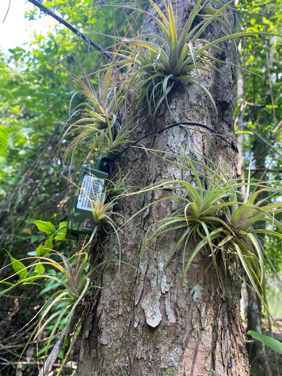
Photo: ©Rony García-Anleu/WCS
3. Unmanned aerial vehicles (also known as “drones”): Various conservation tasks assist, including monitoring the progress of forest restoration areas, monitoring phenology, and monitoring water bodies. Additionally, drones have also been used as a support tool in patrols and fire control tasks.
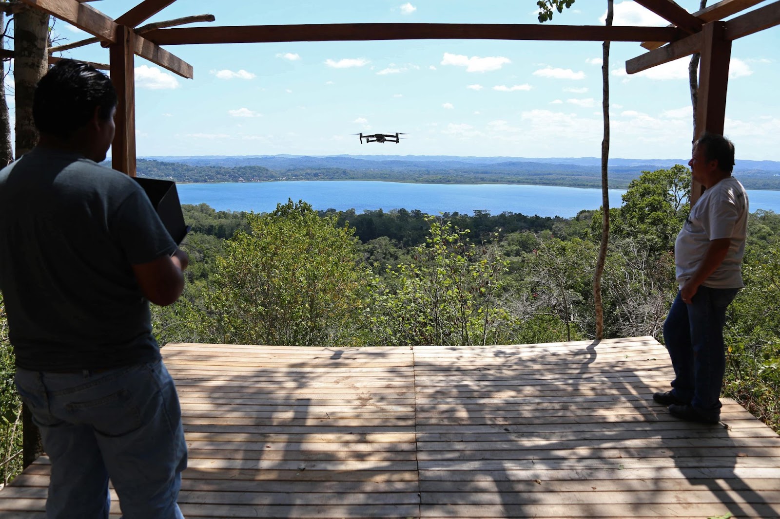 Photo: Phenology monitoring with drones, Biotopo Cerro Cahuí, 2020.©Victor Hugo Ramos/WCS
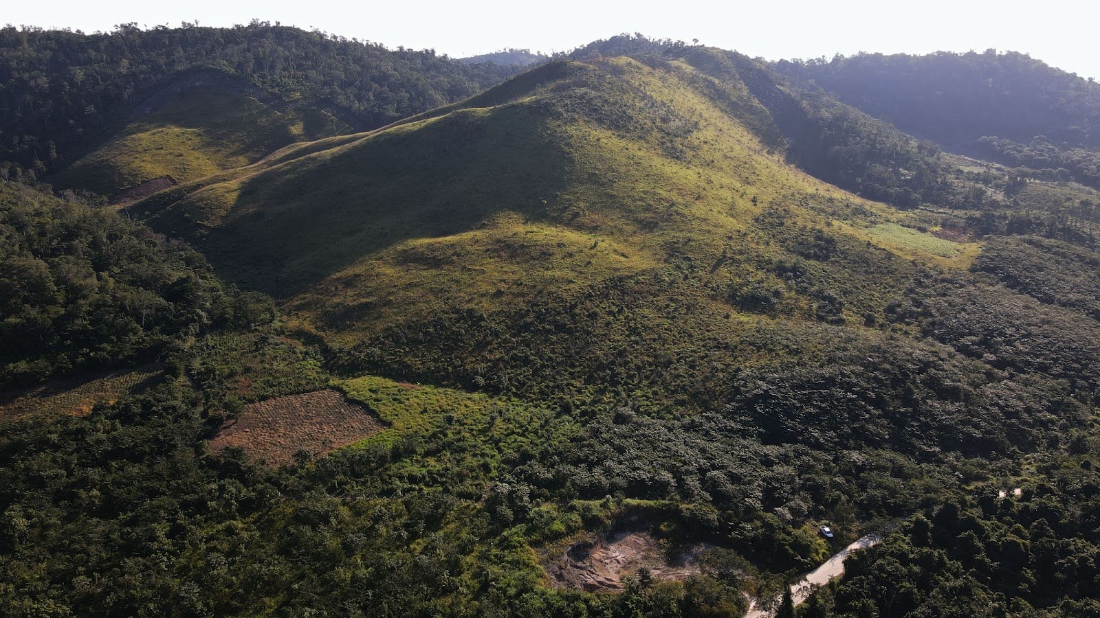 Photo: Plots in the process of restoration in the Maya Forest. ©César Paz/WCS
4. Remote sensing technologies: They have had a variety of applications, including land use, fire and climate monitoring. These tasks are key to evaluating the impact of conservation actions and assisting in decision-making related to fire prevention and control.
5. Underwater Remote Video Systems (Baited Remote Underwater Video System, BRUVs) have transformed shark monitoring by providing a non-intrusive view of their habitat. These cameras, mounted on structures, allow scientists to study the ecology and behavior of sharks in a way that minimizes stress and human impact. BRUVs technology is essential to collect long-term data, identifying seasonal, migratory and reproductive patterns. Its usefulness extends to the evaluation of biological diversity and the health of the marine ecosystem. By visually documenting interactions, BRUVs improve accurate species identification, vital for implementing effective conservation strategies. In summary, BRUVs stand as an essential tool in shark biological monitoring, providing a deep and sustainable understanding of these species in their natural environment.
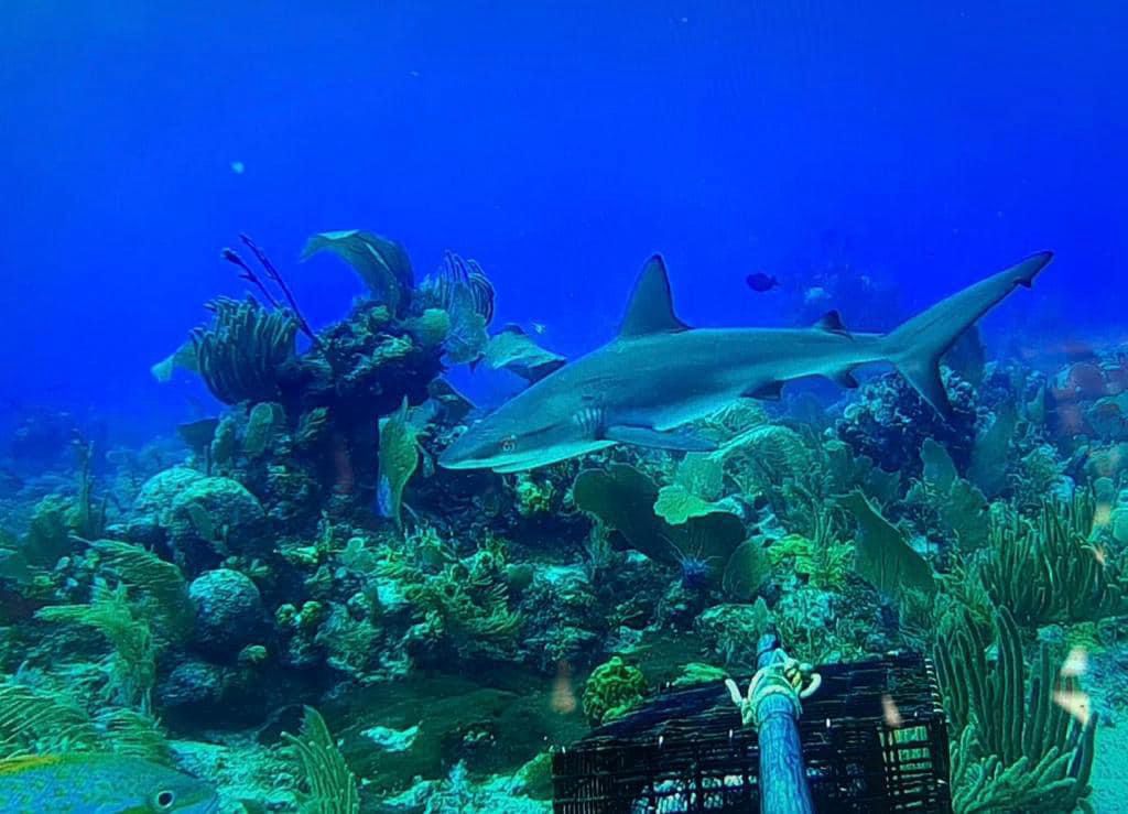 Photo: One of the BRUV'S deployed by Dr. Demian Chapman, shark researcher at Mote. ©Demian Chapman/WCS
6. Bird monitoring with eBird: eBird is a participatory science platform developed by the Cornell Laboratory of Ornithology where birders and scientists can submit bird observations via their smartphones. To date, eBird has more than one billion observations of birds around the world, and scientists are applying machine learning to this huge data set to better understand species distributions, migratory patterns, and trends. We use eBird data products to assess the importance of our landscapes to migratory birds and species of conservation concern. We also use the eBird platform to monitor bird recovery in forest restoration areas.
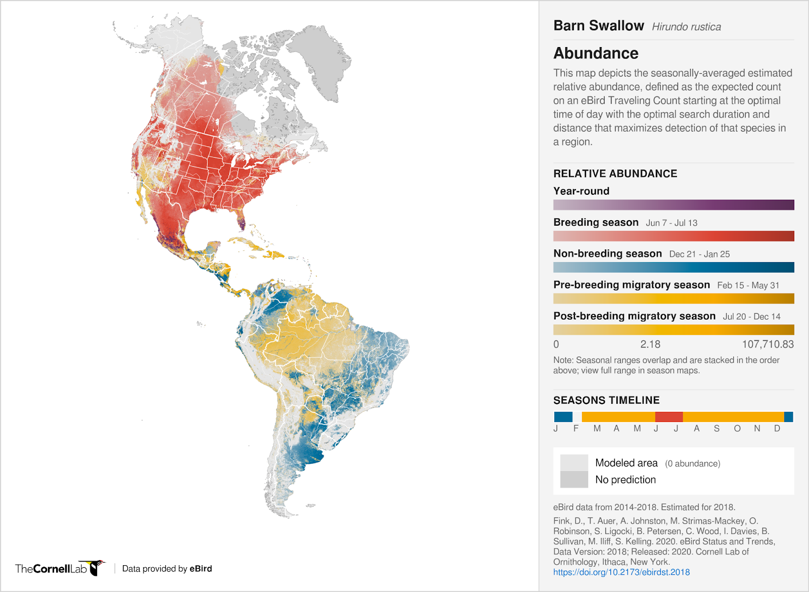 Photo: ©eBird brings together bird observations from around the world and makes them available to researchers, educators and conservationists working tounderstand and conserve birds.
7. Monitoring of migratory birds with Motus: Motus is an international collaborative research network that uses coordinated automated radio telemetry to facilitate research on the ecology and conservation of migratory animals. For example, the Motus network of stations can detect birds positioned throughout their migration to better understand where they are going. This March of this year, we will be placing the first Motus station for Petén in Tikal National Park, to learn more about how birds use the Mayan Forest as a migratory route.
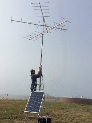
Photo: Installation of a Motus station. ©Tianna Burke
Let's continue exploring new ways to connect people with the planet, using technology as a powerful ally!
Happy World Wildlife Day!
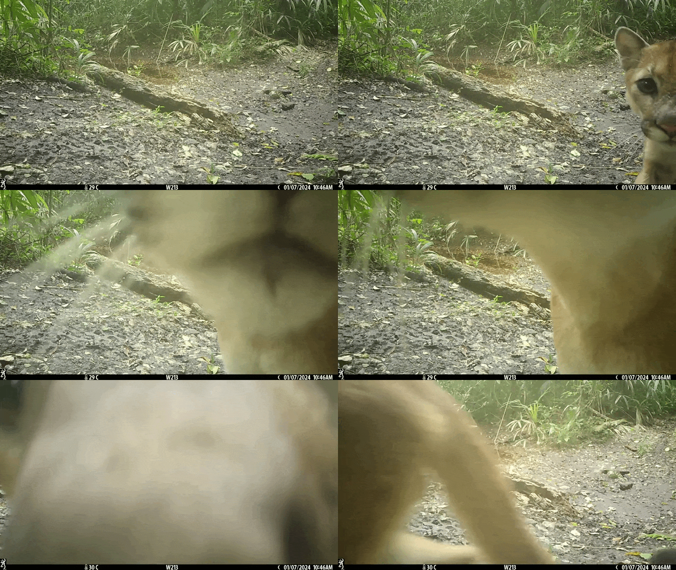
Video: Pumas are solitary animals, and each individual usually has a large home range. ©WCS Guatemala
Text by WCS Mesoamerica and the Caribbean in collaboration with Christian Barrientos, Rony García-Anleu, Víctor Hugo Ramos, Francis Lean, Anna Lello-Smith, Claudia Novelo Alpuche and Bianca Padilla.