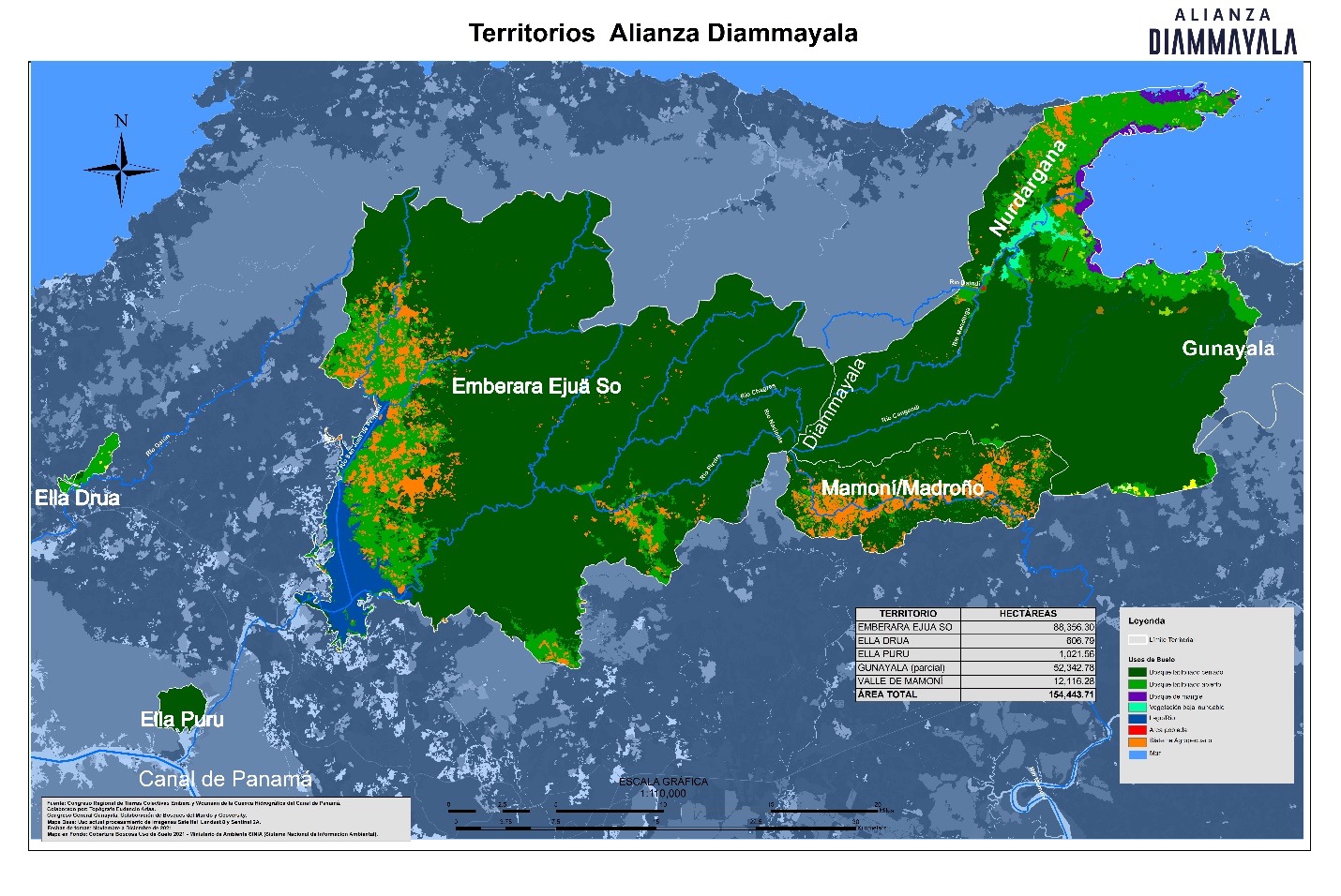
To the northeast of Panama City, there is a conservation community known as the Mamoni Valley Reserve, which spans 4,820 hectares and borders the Gunayala and Emberara Ẽjuä So Indigenous territories, as well as the protected areas of Narganá and the Chagres National Park. It holds strategic importance as part of the 5 Great Forests of Mesoamerica because it faces the highest risk of fragmentation among the vast forests that extend from the Darién region to the Panama Canal.
According to a study conducted by the University for International Cooperation (UCI), the primary environmental threats to this area are deforestation, illegal hunting, and the increase in unplanned settlements. Additional threats that intensified during the pandemic include illegal mining, while historical challenges include deforestation linked to cattle ranching and land encroachment.
Although the Mamoni Valley forest has experienced the least loss of forest cover among the 5 Great Forests, Claus Kjaerby, the Director of Operations for the organization Geoversity and an ally of WCS, highlights that the concern extends beyond forest conservation; it is also about protecting water resources. The water that flows through these territories is essential for the operation of the Panama Canal and serves as the sole source of drinking water for the capital city and surrounding areas. Heraclio López, a Geoversity consultant, explains that preserving these water sources is vital not only for the wellbeing of indigenous and rural communities but also for Panama and the world.
The Mamoní Valley is home to felids, such as pumas (Puma concolor), ocelots (Leopardus pardalis), and margays (Leopardus wiedii). It provides habitat for birds, including the endangered great green macaw (Ara Macao), and an important population of the harpy eagle (Harpia harpyja).
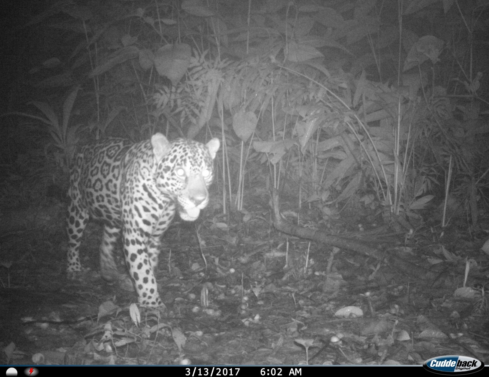 Photo by Geoversity: Jaguar captured in the Mamoní Valley, Panama.
DIAMMAYALA INITIATIVE (“WHERE WATER IS BORN”)
In collaboration with Geoversity, which has been engaged in conservation, restoration, and research projects since 1991, the Diammayala initiative, which means "where water is born" in the Guna language, is created as a response to protect water and territory. This initiative is intricately linked to the three distinct territories of the Gunayala Comarca, Emberara Ẽjuä So, and the communities of the Mamoní Valley, each characterized by unique land ownership and governance structures.
In the upper Mamoní watershed, the land comprises private properties, while Gunayala boasts the distinction of being the oldest officially recognized indigenous self-government territory in Panamá. On the western front, the Emberá-Wounaan communities are merely in the process of securing their territorial rights. The conservation of natural resources hinges on the collaboration of these three diverse cultures, unified through the Dianmayala Initiative.
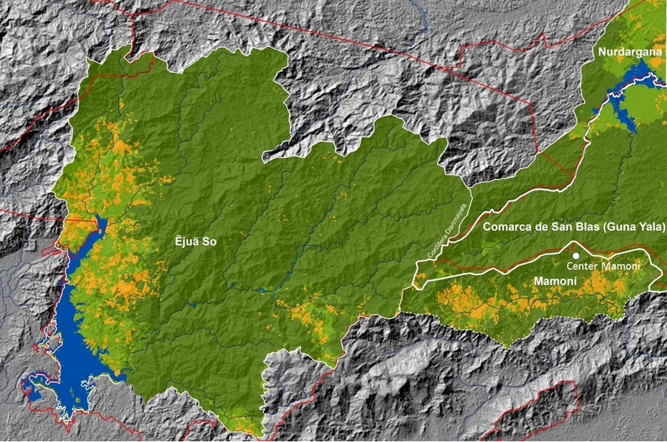 Map by Geoversity of the territories of the Diammayala Initiative.
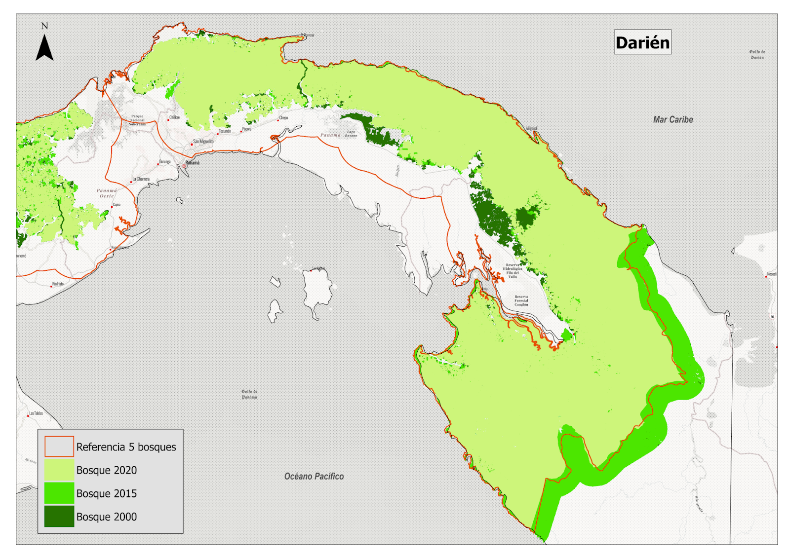 Map: Forest loss from 2000 to 2020 in El Darién. Source: WCS 2022.
The Diammayala Initiative comprises several key components. Beyond ensuring resource preservation, it serves as a school or campus for biocultural leadership training of indigenous youth and authorities, businesses, executives, students, researchers, citizens and the private sector.
The initiative's primary objectives are threefold:
1. The establishment of an interterritorial, intercultural, and multi-stakeholder alliance, involving indigenous communities, conservation organizations, the private sector, and civil society. This alliance aims to promote a comprehensive macromanagement model, ultimately seeking recognition and potential inclusion by state institutions, particularly the Ministry of the Environment.
2. The protection and restoration of ecosystems and biological diversity within all watersheds surrounding the Diammayala mountain.
3. The creation of the most comprehensive and advanced biocultural leadership training and research campus ever developed.
SMART: A TOOL TO TECHNICALLY AND SCIENTIFICALLY DOCUMENT THE CONFLICTS IN THE TERRITORY
In alliance with WCS and Re:wild, a SMART (Spatial Monitoring and Reporting Tool) training workshop was held at the Geoversity’s Mamoní Training and Research Center. Over 20 territorial guardians from Emberara Ẽjuä So, Gunayala and Mamoní attended the aim of improving their monitoring and management capabilities in their territory.
The SMART platform can be installed as an application on mobile phones that are resistant to extreme temperature and water conditions. The information collected is analyzed through software that enables the creation of databases. In addition, it allows more effective monitoring of animal populations at risk, positive initiatives, the detection of illegal activities and the evaluation of conservation strategies.
Julio Maaz, a SMART specialist from the WCS Belize Program, details that one of the advantages of this application is that the data model can be adapted to the language of the park rangers, since many of them are Indigenous and some species of fauna and flora are referred to the devices in their native tongue: “You have to go to the field to understand what park rangers face,” he explains.
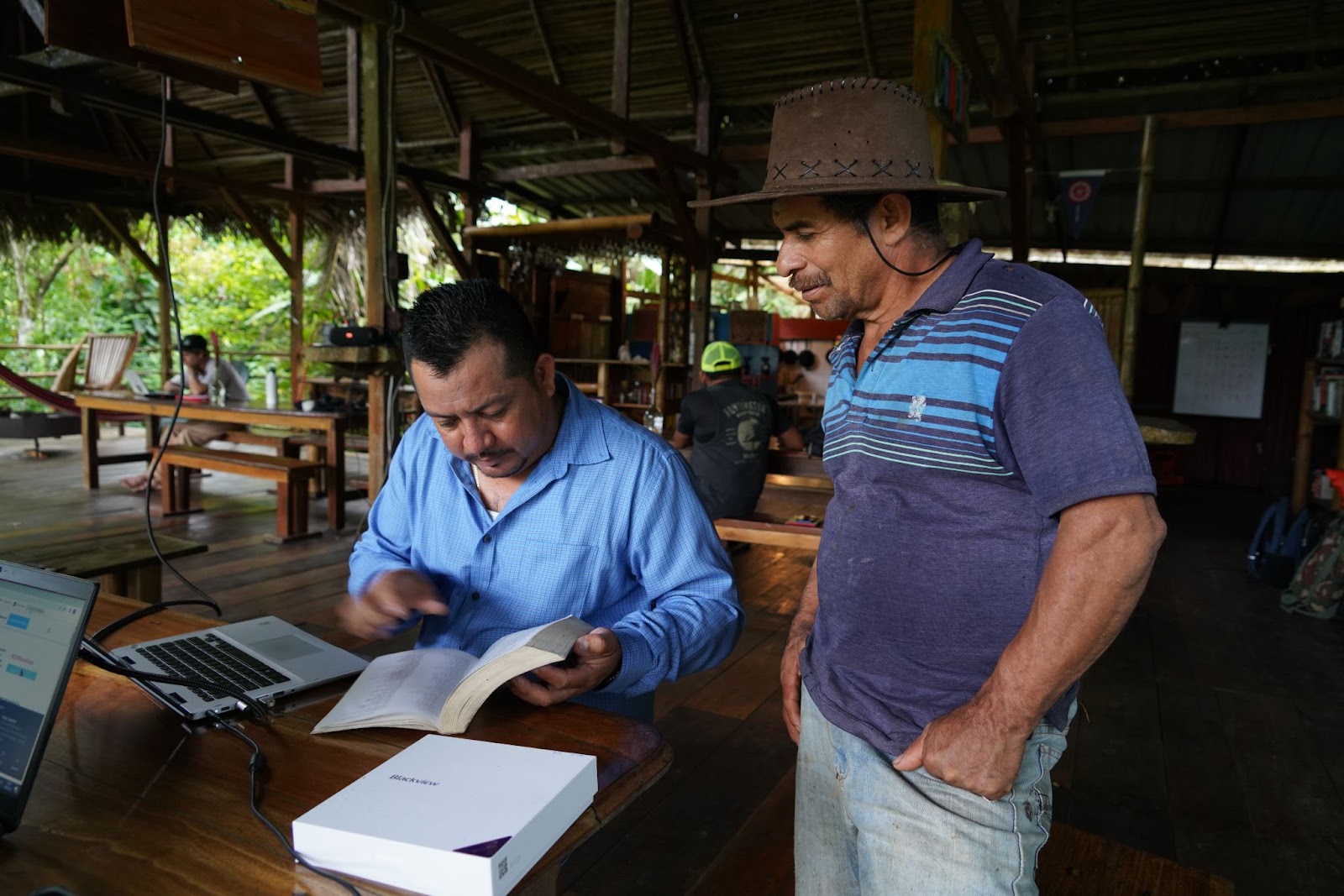
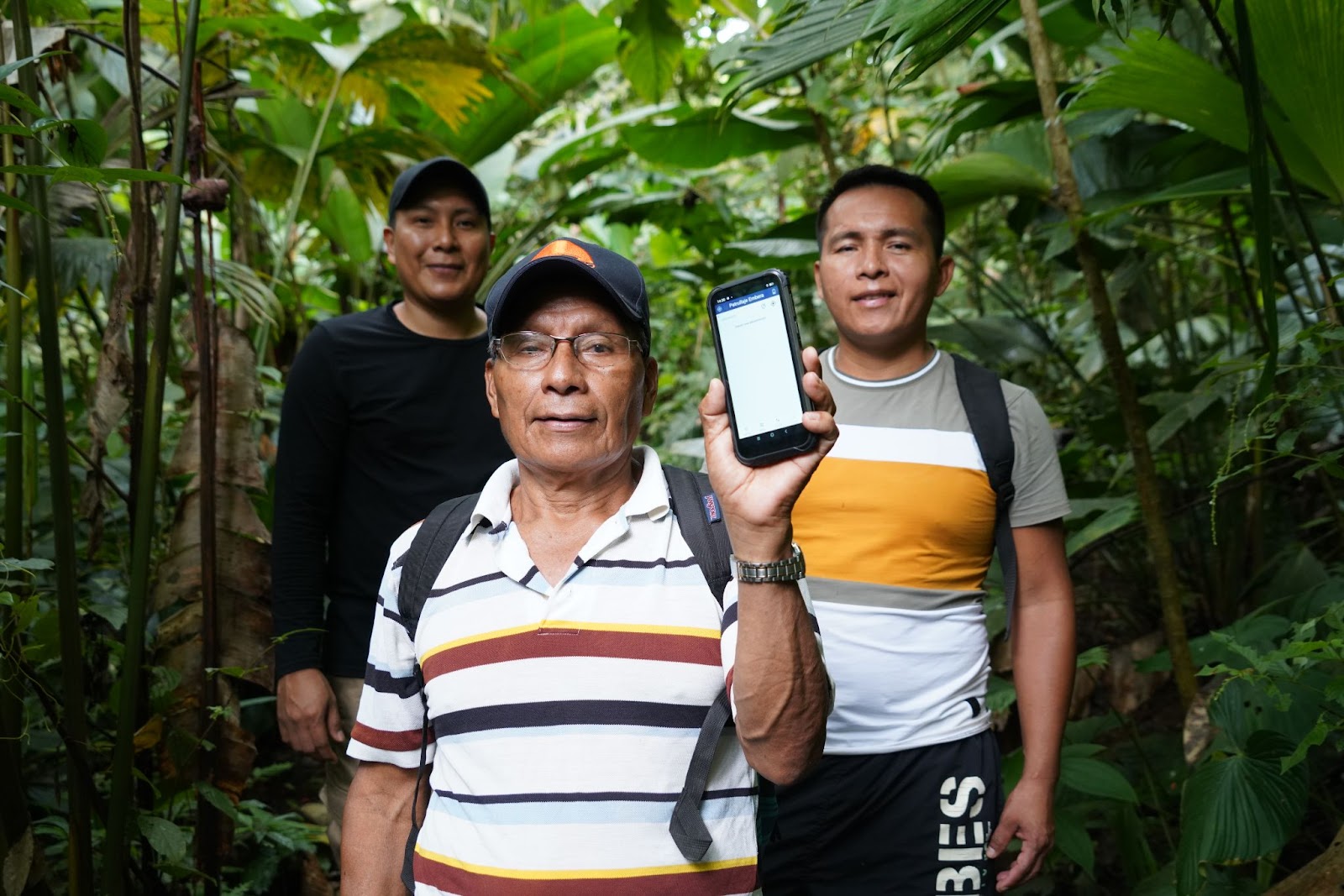 Left photo:Julio Maaz and Gabriel Salazar Guevara, Geoversity collaborator during the SMART training held at the Mamoní Center. Right photo: Park rangers during the patrol at Cerro Brewster (Cerro Diammayala).
For Eudencio Arias Mori, a specialist in Geoversity´s Geographic Information Systems specialist, training is extremely important because “This way we can document, technically and scientifically, the conflicts that exist in the territory and provide it to the authorities”. On the other hand, Heraclio López explains that previously the park rangers easily lost the information they wrote down in their notebooks, and this technology will help the management of the area and its natural resources.
Atala Beckford, Geoversity's international projects cooperation coordinator, states that the territorial guardians of the three territories of the initiative will carry out joint patrols to protect the Mamoní Valley and its buffer zone. The selection of participants was based on consensus with the communities in a free, prior, and informed manner.
Throughout the three-day workshop, the guardians embarked on an excursion to the Continental Divide which is also the limit between the Mamoní valley and Gunayala. During this trek, they documented the distance covered, captured photographs of animal tracks on the ground, and identified various tree and plant species.
This training program serves as a valuable complement to other workshops organized by Geoversity and its partners. Upcoming workshops will emphasize critical topics such as human and environmental rights. These sessions aim to equip both the local community and territorial guardians with the essential knowledge required to make informed decisions at both the community and policy levels.
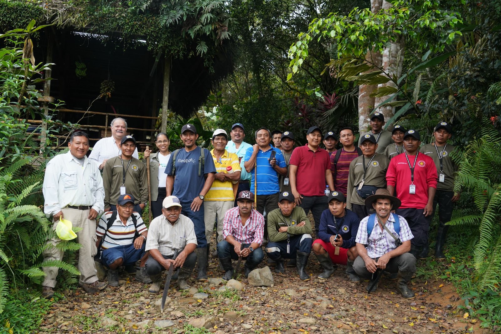 Photo: Territorial guardians that participated in the SMART workshop in the Mamoní Valley.
Photos and texts by Claudia Novelo Alpuche. Camera trap photographs by Geoversity. Maps by Geoversity and Marco Martínez. The opinions expressed in this information product are the responsibility of its author(s), and the GCF cannot be held responsible for any use made of the information contained therein.